Land Survey
Datum Surveys
Land, Engineering & Measured Building Surveys
Land/Topographical surveys
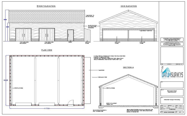
The topographical survey is the most common commissioned type of survey, and provides decision makers such as Developers, Architects, Local Authorities and private land owners with dimensionally accurate drawings for any given area of land.
Using total stations with reflectorless capabilities, Datum Surveys can measure all sizes of plot, be it private dwellings, or much larger areas of land for housing developers.
The amount of detail required is determined by the Client, butour general specification includes boundaries, building lines, service covers, trees and levels. The level information is very important, as it can be used as the basis for determining floor slab levels, the maximum height of proposed buildings, the positioning of roads, and landscaping features of the works. Drainage runs can also be plotted with invert levels where accessible.
Measurements will be taken in three dimensions, so that the survey can be presented in both 2D & 3D formats as required.
Ordnance Survey and Land Registry data can be overlaid onto the survey in order to identify boundaries and the positioning of more distant buildings, in relation to the survey.
Highway surveys
These are, generally speaking, a very detailed form of topographical survey, following the relevant Local Authority’s highways department customised specification. Datum Surveys measure all types of roads, both urban and rural, for: maintenance works; feasibility of redesigned road systems for traffic flow; any other scheme required. We have 18year’s experience in all aspects of highway survey, and presentation of collected data.